Debby’s path changed again; warnings dropped for Louisiana
Published 4:37 pm Sunday, June 24, 2012
NEW ORLEANS (AP) — Parts of Florida and Alabama were under a tropical storm warning Sunday as Debby churned off the Gulf Coast, leaving wary residents to closely watch a storm whose path has so far been difficult to forecast.
Underscoring the storm’s unpredictable nature, forecasters discontinued a tropical storm warning for Louisiana after forecast models indicated Debby was less likely to make a westward turn than initially predicted. Coastal Alabama and parts of Florida, including the Panhandle, remained under tropical storm warnings.
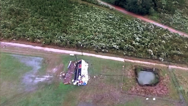
Debby already had dumped heavy rain on parts of Florida and spawned some isolated tornadoes, causing some damage to homes and knocking down power lines. High winds forced the closure of an interstate bridge that spans Tampa Bay and links St. Petersburg with areas to the southeast.
Storm tracks are difficult to predict days in advance. But as of late Sunday the latest forecast map shows the center of the storm 100 miles (165 km) south-southwest of Apalachicola, Fla., and likely to meander northward for several days before making landfall.
Chris Landsea, a meteorologist at the National Hurricane Center, said forecasters rely on computer models which were contradictory until Sunday.
“They came into a bit more of an agreement that the westward turn is less likely,” he said.
Landsea said every storm is different and has different characteristics, “and in this case it’s a very unpredictable storm.” He said Debby was could become a hurricane.
A major concern will be flooding from heavy rainfall. Parts of Florida and southeast Georgia could receive 10 to 15 inches of rain, with some areas getting as much as 20, he said.
Debby’s top sustained winds were at about 60 mph (95 kph). The storm was moving toward the northeast at 3 mph (6 kph).
Near the mouth of the Mississippi southeast of New Orleans, Plaquemines Parish President Billy Nungesser said officials were making preparations to protect the main highway from tidal flooding.
At least one tornado linked to the storm touched down Saturday in southwest Florida, but no injuries were reported. Another was reported Sunday in Venice, damaging some homes.
“This is quite common with this type of storm,” senior hurricane specialist Stacy Stewart with the National Hurricane Center said of the twisters. “They tend to not be very large or long-lived, which can be difficult to detect on radar. So people need to keep an eye on the sky.”
However, despite warnings in the Panhandle, Debby hadn’t totally dampened vacations.
Thousands were on the beach at Pensacola Beach, Fla., on Sunday morning. Many used their phones to take photos of huge waves crashing into the concrete supports of a fishing pier. There wasn’t any rain yet; just gusty winds and dark, fast-moving clouds.
Few people were in the water. Red flags warned tourists to stay out of the surf, and lifeguards cruised the sand on all-terrain vehicles, blowing whistles at anyone who got near the waves.
Workers with rental companies used pickup trucks to gather chairs and umbrellas as a precaution against an unusually high tide.


