Miss-Lou preparing for flooding, possible tornadoes from Hurricane Laura
Published 8:17 pm Tuesday, August 25, 2020
- file photo
|
Getting your Trinity Audio player ready...
|
Adams County Emergency Management officials are making preparations for localized flooding, possible tornadoes and damaging wind gusts after Hurricane Laura makes landfall Wednesday.
The National Weather Service in Jackson said Natchez and Adams County are under a light risk of severe weather associated with the storm, which is forecast to move through the Wednesday night through Thursday.
Adams County residents should expect sustained winds of 20-25mph with gusts up to 39 mph Wednesday night. Residents of Concordia Parish could experience wind gust of up to 50mph.
With the high winds, some downed trees and powerlines are possible.
The area should expect to see 1 to 3 inches of rain, with localized flooding possible, particularly in lower lying areas. Parts of the Miss-Lou, particularly in Concordia Parish could see up to 4 inches of rain with an elevated threat of flash flooding.
Adams County EMA Director Robert Bradford said area officials are making preparations and will continue to monitor the storm as it approaches the Gulf Coast.
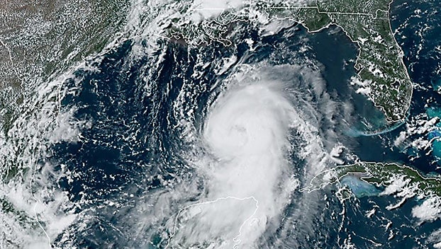
The National Hurricane Center projected that Laura would draw energy from warm Gulf waters and become a Category 3 hurricane before making landfall late Wednesday or early Thursday, with winds of around 115 mph.
“The waters are warm enough everywhere there to support a major hurricane, Category 3 or even higher. The waters are very warm where the storm is now and will be for the entire path up until the Gulf Coast,” National Hurricane Center Deputy Director Ed Rappaport said.
Ocean water was expected to push onto land along more than 450 miles of coast from Texas to Mississippi. Hurricane warnings were issued from San Luis Pass, Texas, to Intracoastal City, Louisiana, and storm surge warnings from the Port Arthur, Texas, flood protection system to the mouth of the Mississippi River.
As of Tuesday afternoon, Laura was 525 miles southeast of Lake Charles, Louisiana, traveling northwest at 16 mph. Its peak winds were 75 mph.
As much as 15 inches of rain could fall in some parts of Louisiana, said Donald Jones, a National Weather Service meteorologist in Lake Charles, Louisiana — near the bullseye of Laura’s projected path.
On Tuesday, the Vidalia Town Council declared a public health emergency ahead of the storm and voted to grant Mayor Buz Craft emergency powers for town operations in response to the storm.
After the meeting, Craft said he and others on the town council met with department heads to make sure everything was ready.
Craft said the town’s various drains have been cleaned and are free of debris in case of torrential rains. Craft also said a generator will be set up at the Vidalia Conference and Convention Center in the event that power is needed for residents.
Craft said he hopes the storm will be a “non-event” for the area, but the town is preparing for the worst just in case.
In Natchez, Entergy crews are also preparing for the storm.
Tim Runnels, Entergy customer service representative, said Entergy prepares it’s crews well in advance for power outages associated with storms projected to pass through their service area.
Runnels said Entergy is prepared to bring in crews from outside of Adams County if needed to repair any storm damage.
“We are prepared for this storm and we recommend our customers prepare as well. Entergy will work hard to restore your power if power is lost. We want to remind the public to be safe and stay clear of any broken poles and downed power lines.”
Runnels said to report any outages or downed power lines, call Entergy at 1-800-368-3749.
More News


-
Polls
 Loading ...
-
-